
Get to know the surroundings of Girona
Walking routes
The Secret Costa Brava
Beaches, viewpoints, "cami de ronda"... all in a stretch of the most beautiful of the Costa Brava and the least known.
Circular route to one of the most unknown and spectacular places on the Costa Brava.
DISTANCE: 7 km
ALTITUDE: 400 m
DIFFICULTY: low
6 (рекомендации местных жителей)
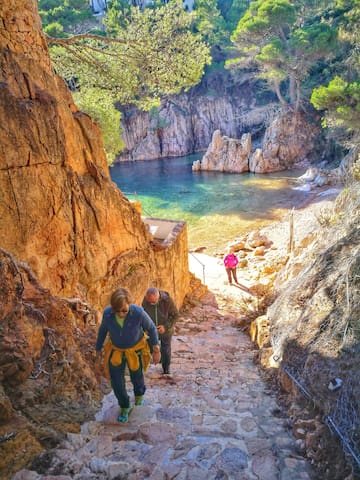
Cala Marquesa Aigua Xelida
The Secret Costa Brava
Beaches, viewpoints, "cami de ronda"... all in a stretch of the most beautiful of the Costa Brava and the least known.
Circular route to one of the most unknown and spectacular places on the Costa Brava.
DISTANCE: 7 km
ALTITUDE: 400 m
DIFFICULTY: low
Banyoles, from heaven to hell!
We will go up to the top of the sky, the Puig Clarà where we will see the lake from a bird's eye view and we will go down to the same hell in the cracks of the Estunes.
A beautiful easy circular route where you can see the magnificent Romanesque church of Porqueres next to the lake, go up to one of the most spectacular viewpoints in the region, go through the recovery area of the storks and go down to the bowels of the earth in the Estunes. All this in one morning ... that's good!
DISTANCE: 9.5 km
ALTITUDE: 160 m
DIFFICULTY: low
72 (рекомендации местных жителей)
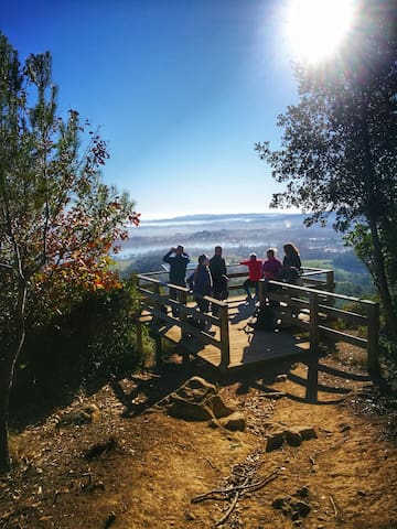
BANYOLES
13 Carrer dels ServitesBanyoles, from heaven to hell!
We will go up to the top of the sky, the Puig Clarà where we will see the lake from a bird's eye view and we will go down to the same hell in the cracks of the Estunes.
A beautiful easy circular route where you can see the magnificent Romanesque church of Porqueres next to the lake, go up to one of the most spectacular viewpoints in the region, go through the recovery area of the storks and go down to the bowels of the earth in the Estunes. All this in one morning ... that's good!
DISTANCE: 9.5 km
ALTITUDE: 160 m
DIFFICULTY: low
RocaMaura l'Estartit from the sky
You may know Estartit and the Medes Islands, but we suggest you see it from another perspective, from Rocamaura.
DISTANCE: 10.15 km
ALTITUDE: 390 m
DIFFICULTY: low / medium
47 (рекомендации местных жителей)
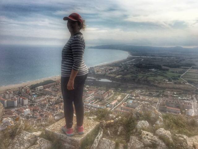
L'Estartit
RocaMaura l'Estartit from the sky
You may know Estartit and the Medes Islands, but we suggest you see it from another perspective, from Rocamaura.
DISTANCE: 10.15 km
ALTITUDE: 390 m
DIFFICULTY: low / medium
We will follow the coastal façade to the south of L'Escala, passing by Punta Montgó with its fortified tower, Cala Montgó, until we reach Punta Ventosa.
We will go through different bunkers and learn about their history
DISTANCE: 12 km
ALTITUDE: 300 m
DIFFICULTY: low
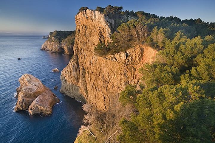
Punta Ventosa
We will follow the coastal façade to the south of L'Escala, passing by Punta Montgó with its fortified tower, Cala Montgó, until we reach Punta Ventosa.
We will go through different bunkers and learn about their history
DISTANCE: 12 km
ALTITUDE: 300 m
DIFFICULTY: low
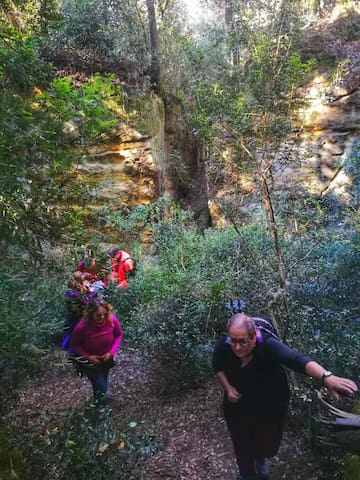
Beautiful circular excursion where we will visit some of the most characteristic medieval villages of the Baix Empordà: Peratallada.
We will pass by some curious quarries and holes from the pre-Roman period, following a part of the Camí d'Empúries, an ancient road used by the Iberians to connect Girona, with Ullastret and Empúries.
DISTANCE: 8 km
ALTITUDE: 100 m
DIFFICULTY: low
263 (рекомендации местных жителей)
Peratallada
Beautiful circular excursion where we will visit some of the most characteristic medieval villages of the Baix Empordà: Peratallada.
We will pass by some curious quarries and holes from the pre-Roman period, following a part of the Camí d'Empúries, an ancient road used by the Iberians to connect Girona, with Ullastret and Empúries.
DISTANCE: 8 km
ALTITUDE: 100 m
DIFFICULTY: low
Bike routes
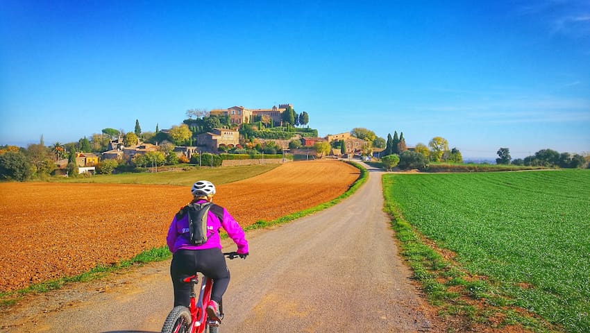
Empordanet and medieval villages: Pals & Peratallada,
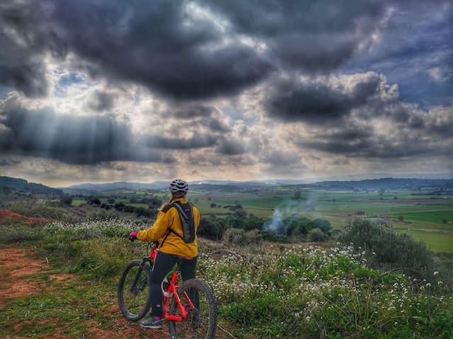
You can't miss this circular route that goes through the Empordanet de Josep Pla. We will pass through medieval villages, climb an exceptional viewpoint, listen to legends and stories of the Indiketes.
Everything at a slow pace, to admire the landscape, without haste, is no competition.
DIFFICULTY: Low
KILOMETERS: 33
ACCUMULATED ALTITUDE: +300 m
Suitable for e-bike, mountain biking, gravel or trekking bike
263 (рекомендации местных жителей)
Peratallada
Empordanet and medieval villages: Pals & Peratallada,
You can't miss this circular route that goes through the Empordanet de Josep Pla. We will pass through medieval villages, climb an exceptional viewpoint, listen to legends and stories of the Indiketes.
Everything at a slow pace, to admire the landscape, without haste, is no competition.
DIFFICULTY: Low
KILOMETERS: 33
ACCUMULATED ALTITUDE: +300 m
Suitable for e-bike, mountain biking, gravel or trekking bike
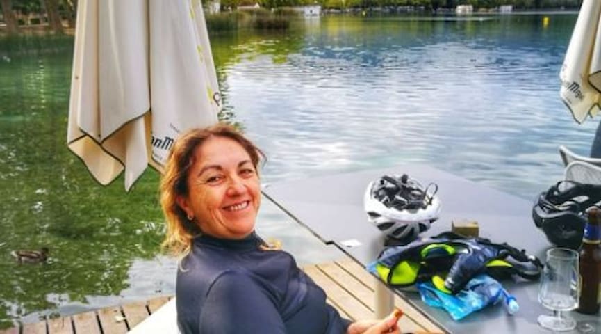
We will pass by greenways, forests, the lake of Banyoles where we will have a coffee.
Everything at a walking pace, to admire the landscape, without haste, is no competition.
DEPARTURE TIME: 10:30
DIFFICULTY: Low
KILOMETERS: 56
ACCUMULATED ACCUMULATED ALTITUDE: +580 m
72 (рекомендации местных жителей)
BANYOLES
13 Carrer dels ServitesWe will pass by greenways, forests, the lake of Banyoles where we will have a coffee.
Everything at a walking pace, to admire the landscape, without haste, is no competition.
DEPARTURE TIME: 10:30
DIFFICULTY: Low
KILOMETERS: 56
ACCUMULATED ACCUMULATED ALTITUDE: +580 m
Gironès and Baix Empordà route with craft beer tasting:
Rupià, Corcà, Monells, Madremanya, Sant Martí Vell, Bordils, Flaçà, Foixà
7 (рекомендации местных жителей)
Baix Empordà
Gironès and Baix Empordà route with craft beer tasting:
Rupià, Corcà, Monells, Madremanya, Sant Martí Vell, Bordils, Flaçà, Foixà
Route Garrotxa volcanic zone, Fageda d’en Jordà and Santa Pau
Circular route that will not leave anyone indifferent. We will ride through the best preserved volcanic area of the peninsula, between volcanoes and lush beeches. We will visit secret hermitages, idyllic villages and get to know how the people of the territory live.
DISTANCE: 40km
ALTITUDE: 600 m
DIFFICULTY: Medium
26 (рекомендации местных жителей)
Santa Pau
Route Garrotxa volcanic zone, Fageda d’en Jordà and Santa Pau
Circular route that will not leave anyone indifferent. We will ride through the best preserved volcanic area of the peninsula, between volcanoes and lush beeches. We will visit secret hermitages, idyllic villages and get to know how the people of the territory live.
DISTANCE: 40km
ALTITUDE: 600 m
DIFFICULTY: Medium
An easy route without unevenness, suitable for anyone who knows how to ride a bike.
We will leave the Devesa de Girona, direction "les Hortes de Santa Eugenia" a second of very well-kept orchards, let's go to the Deveses de Salt.
After approximately 7 km we arrive at the pilaster, an idyllic place to rest for a moment and contemplate the river Ter. It is an area where canoeists train.
We arrived at Bescanó
Distance: 16km
Slope: 20m
Difficulty: Low
Bescanó
An easy route without unevenness, suitable for anyone who knows how to ride a bike.
We will leave the Devesa de Girona, direction "les Hortes de Santa Eugenia" a second of very well-kept orchards, let's go to the Deveses de Salt.
After approximately 7 km we arrive at the pilaster, an idyllic place to rest for a moment and contemplate the river Ter. It is an area where canoeists train.
We arrived at Bescanó
Distance: 16km
Slope: 20m
Difficulty: Low
Рекомендации для путешественников
Транспорт
Where do I find route information?
If you want to do any of these routes, ask us for the data and we will tell you how to do it.